A skyway map that works like transit
Nearly ten miles of climate-controlled walkway connecting roughly 80 blocks - no other American downtown has this. What Minneapolis has never done is decide what the system is actually for. This map is my attempt at an answer.
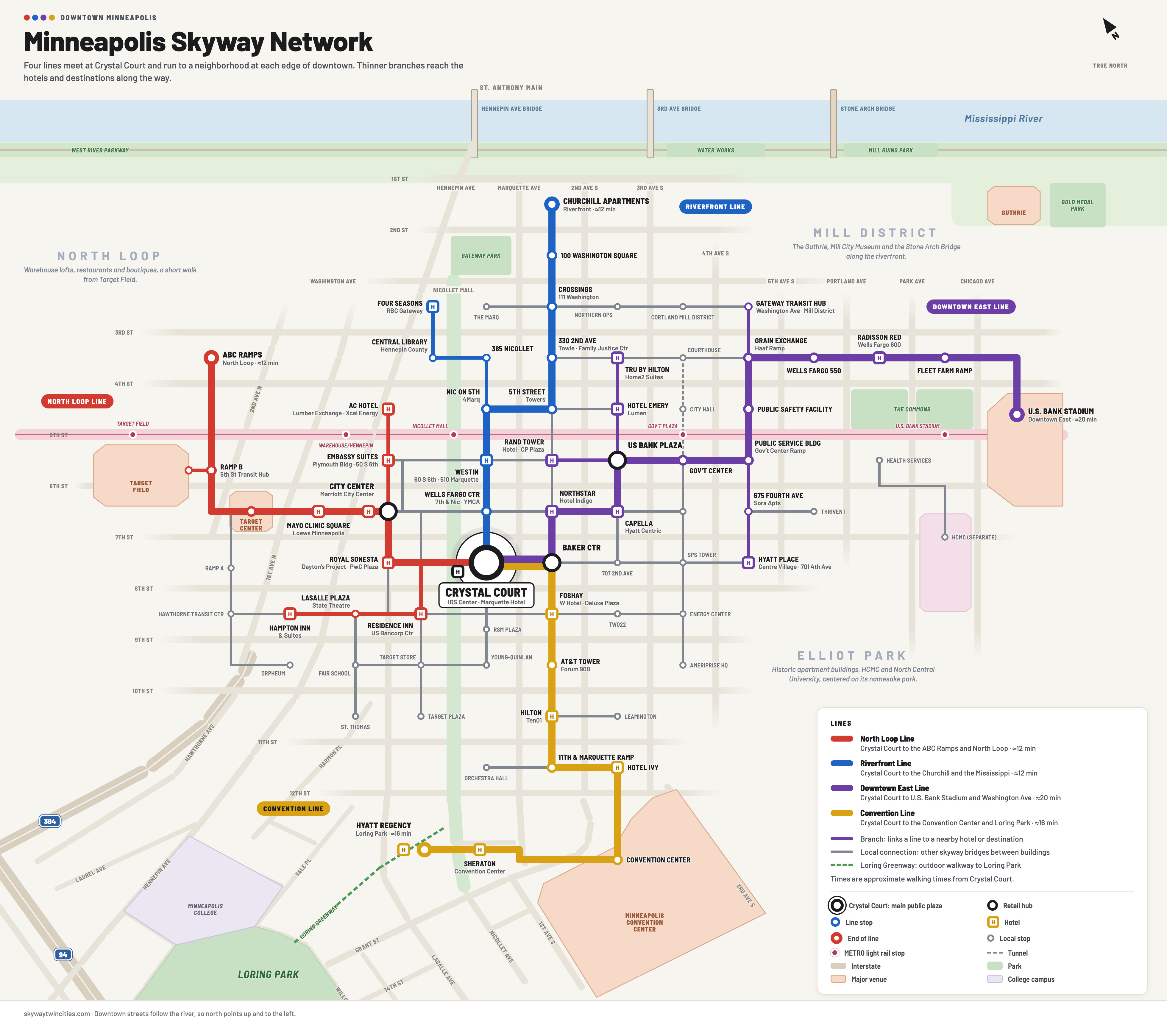 Full resolution
The map starts at Crystal Court, which in practice is already the hub, since the IDS Center connects in every direction. From there, four color-coded lines run to the edges of downtown, each ending at a neighborhood people need to reach after the office towers empty out.
- North Loop LineWest past Target Center and Mayo Clinic Square to the ABC Ramps and Target Field
- Riverfront LineNorth to the Churchill Apartments and the Mississippi
- Downtown East LineEast toward Washington Avenue and U.S. Bank Stadium
- Convention LineSouth to the Convention Center, with the Loring Greenway carrying on outdoors to Loring Park
If a route is drawn in color, it's open - seven days, standardized hours, no matter whose building a given bridge sits in.
Where does the map get it right, and where doesn't it?
If you walk these routes every day, I'd like to hear from you. Corrections, missing connections, buildings that would never sign on - all of it helps.